Beach, Bay, Cove: The Labels Do Not Describe a Scale
Beach, bay, cove: learn what these coastal labels usually describe, from shore material and shape to shelter, so maps and local names make more sense.
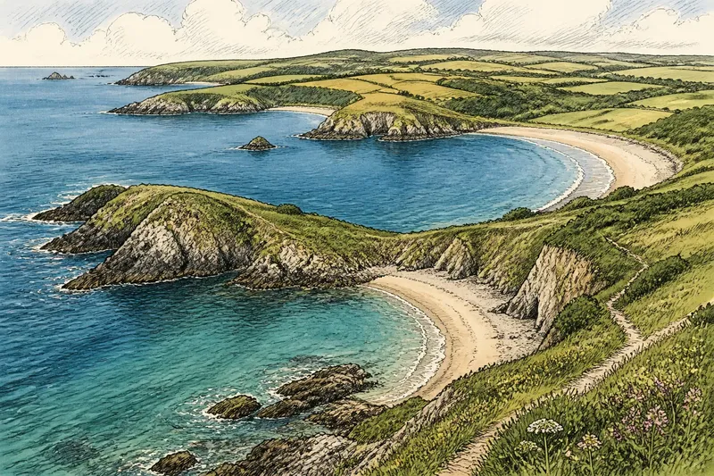
The common mistake is to read “beach,” “bay,” and “cove” as sizes on a descending scale. That assumption can leave a map or shoreline description more confusing than it began: a cove may be broad, a bay modest, and a beach only a narrow strip. Beach, bay, and cove tell you different kinds of things about a coast, and none is a dependable ruler.
Three different clues
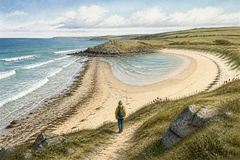
A beach describes a shore surface or landform: a stretch where loose material such as sand, gravel, or pebbles meets the water. It says something about what the edge is made of and how it presents itself, not how much open water lies behind it. A beach can border the sea, a lake, or another body of water, and it may sit inside a bay or cove.
A bay describes a coastal indentation, usually where water extends into land and the surrounding shore partly encloses it. The word directs attention to the outline and relationship between land and water. It does not require the place to be larger than every feature called a cove, nor does it promise calm water.
A cove commonly describes a small or sheltered inlet, often with a curved or enclosing shoreline. Its associations are useful, but not exact specifications. Local usage, the shape of the coast, and the history of a name can all influence which word people choose.
These labels answer different questions. “Beach” points toward the shore itself. “Bay” and “cove” point toward water and the way land surrounds it. A place can fit more than one description without contradiction.
Shore and water
To read the words clearly, imagine looking at a coastal map and then standing at the water’s edge. On the map, you may see a curved indentation. That feature could be called a bay or a cove. At the edge, you may see sand or pebbles; that shore may be called a beach. The map label and the ground-level description can both be accurate because they refer to different parts of the scene.
Not every shore is a beach. A coast may end in a rocky ledge, a cliff, salt marsh, or a structure built along the water. Nor does every bay have a sandy shore. The water may meet rock in one section and a strip of shingle in another. “Bay” names the larger coastal form; it does not specify the material underfoot.
Likewise, “beach” does not tell you that the shore is open or exposed. A small beach can lie within a sheltered inlet, while a long beach may face open water. The term alone gives no reliable account of wave conditions, access, or how the shoreline changes through the day.
Why names overlap
Coastal language is partly descriptive and partly inherited. A place name may preserve the word used by residents or chartmakers, even if another term seems more fitting to a visitor. A named bay may contain a feature locals call a cove; a small beach may carry a name that sounds like a separate geographic unit. Names do not always follow a tidy classification system.
Words can also be used at different levels. “Bay” might identify a broad stretch of coast on a regional map, while “cove” identifies a smaller inlet within it. In ordinary speech, however, people may use either term for much the same indentation. The scale of the map and the speaker’s purpose affect the level of detail.
There is no universal dividing line at which an inlet stops being a cove and becomes a bay. Some descriptions emphasize enclosure; others lean on familiar local usage. The useful move is not to demand a precise boundary from the word, but to look for the feature it is most likely naming.
Reading a coastal map
When a map uses one of these labels, treat it as a first clue, then check the outline and nearby details. Look for whether the name refers to a strip of shore or to an indentation in the coast. Notice headlands, islands, channels, and beaches drawn within the larger feature. A label may identify the whole water pocket while leaving its smaller shores unnamed.
Suppose you are planning a walk and see “Cove” on a map. Imagine the map also shows a narrow opening between headlands and a sandy edge inside it. The word “cove” suggests an inlet, while the mapped edge indicates a beach; checking a local access map would help you distinguish the place’s shape from the route to the shore. The expected result is a clearer description of what you are looking at, not a size ranking inferred from the name.
For practical decisions, the label is not a substitute for current local information. A beach name does not tell you whether a path reaches it, and a cove name does not establish that the water is sheltered under every condition. If access, navigation, or another consequential detail matters, consult appropriate local guidance rather than drawing conclusions from the label alone.
What does each word usually mean?
Does a bay have to be larger than a cove?
No fixed size rule separates the two in everyday coastal naming. A bay often suggests a broader indentation and a cove a smaller or more enclosed inlet, but the terms overlap and local names may not follow that distinction.
Can a beach be inside a cove?
Yes. “Cove” can describe the inlet, while “beach” describes a shore of loose material within it. One word identifies the water-and-land shape; the other identifies the character of the edge.
Does a bay always offer shelter?
No. The indentation may provide some protection from particular directions, but exposure depends on the coast’s orientation and local conditions. The word “bay” by itself is not a forecast or a statement about safe water.
Is a beach always made of sand?
No. Beaches may be composed of gravel, pebbles, or other loose shore material. The word does not specify one texture, and a single beach can include more than one kind of material.
Choosing a precise description
If you are describing a place to someone else, name the feature you mean. Say “the pebble beach inside the bay” when both the shore and the larger indentation matter. Say “the cove on the east side of the headland” when the inlet’s position is the useful detail. This is clearer than trying to select a single word that carries every fact at once.
For a map or guide, preserve established place names, then add a plain description where confusion is likely. A familiar name helps people recognize the location; a phrase such as “small sandy shore within the inlet” clarifies what they will encounter. The two kinds of wording serve different readers and need not compete.
Beach, bay, and cove are better read as overlapping labels than as rungs on a size ladder. The next time one appears on a chart, ask whether it names the shore material, the shape of the water’s edge, or a locally recognized place. That small distinction makes coastal descriptions easier to interpret—and leaves the actual dimensions to the map, not the word.